With the learnings from my first training walk in mind, I set about readying myself for a longer wander in the great outdoors by mentally planning a route at 02:30 when I’d rather been asleep!
As I took my early steps away from home, and with little in the way of route formulated, a quick decision was that today was going to be all about keeping low out of the wind and rain. Walking in open terrain would leave me wet, and the views that normally nourish my brain and spirit would be absent.
A short walk to the top of The Mount reinforced this decision and rather than walking either side of the track, I walked along it, hunkering down against the driving rain. Dropping down from Compton Heights I heard the cat-like mewing of a buzzard as it circled over a field, before all but tripping over a wonderful looking deer. He crashed off a few paces, and we stood and looked at each other through about 5m of undergrowth before he effortlessly bounded over a fence, and across a field. Deer have such fluid majesty in their movement, and I knew this was a good sign for a successful walk.
The sandy track that is this section of the North Downs way along the edge of the Loseley nature reserve reminded me of the time that Sorrel gashed her shoulder on the fallen barbed wire of a collapsed fence. The estate manager claimed to have removed it, but 6 years later it still lies abandoned like a section of Somme trench. There should be more accountability on the part of land-owners.
I was quickly at The Olde Ship, which is a fabulous pub with pizzas the size of small tables, and beer that is wonderfully kept. Dropping down Ferry Lane to the River Way I read the plaque about the ferry that used to transport people across the river, and headed south towards Godalming. The river walk was uneventful and muddy until I crossed the river and headed for the start of the Guildford to Christ’s Hospital railway. A couple of Km later, and I found the junction with the Downs Link.
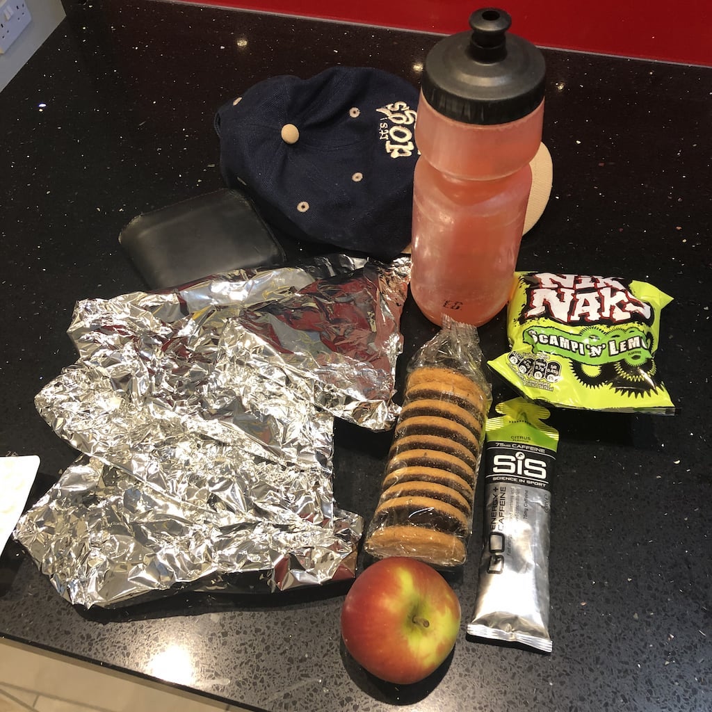
By now I was about 7Km into the walk, and eating more regularly and frequently than last time – principally because I’d brought some food I wanted to eat! We’d been to the Olde Ship the night before, and I had some of the takeaway pizza left. Meat feast and Puttanesca would sustain me for much of the walk.
A brief section of tarmac delivered me to the lower slopes of Chinthurst hill, and I started climbing.
Loseley and the North Downs
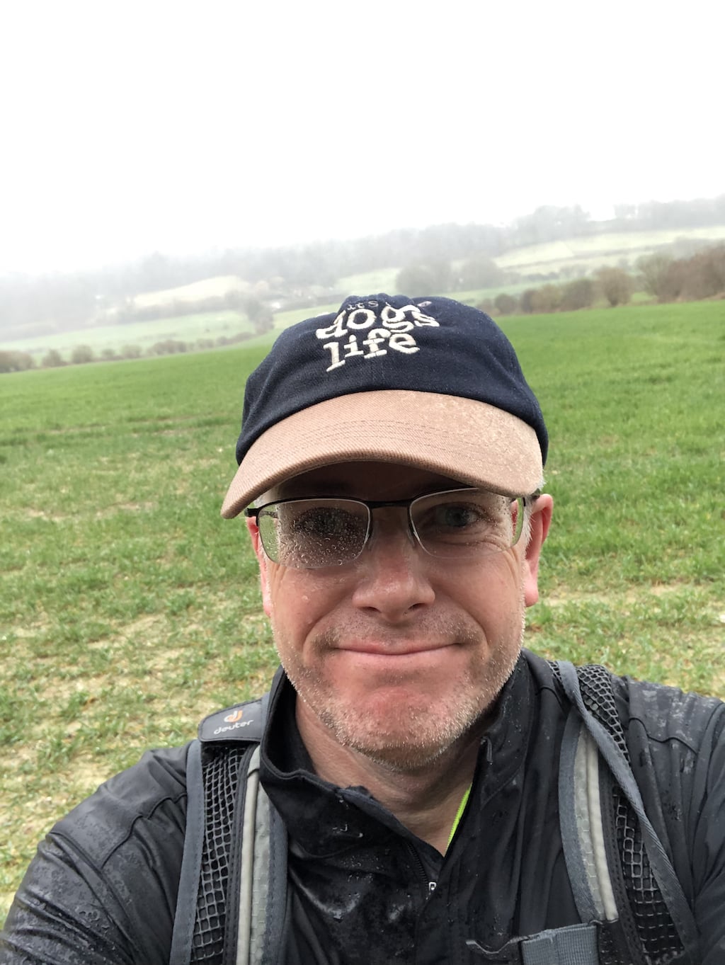
With Storm Freda due to make her appearance in the afternoon of Sunday 3rd March, and after a broken night’s sleep, it was with mixed feelings that I assembled my provisions, ate breakfast, and left the house.As I took my early steps away from home, and with little in the way of route formulated, a quick decision was that today was going to be all about keeping low out of the wind and rain. Walking in open terrain would leave me wet, and the views that normally nourish my brain and spirit would be absent.
A short walk to the top of The Mount reinforced this decision and rather than walking either side of the track, I walked along it, hunkering down against the driving rain. Dropping down from Compton Heights I heard the cat-like mewing of a buzzard as it circled over a field, before all but tripping over a wonderful looking deer. He crashed off a few paces, and we stood and looked at each other through about 5m of undergrowth before he effortlessly bounded over a fence, and across a field. Deer have such fluid majesty in their movement, and I knew this was a good sign for a successful walk.
The sandy track that is this section of the North Downs way along the edge of the Loseley nature reserve reminded me of the time that Sorrel gashed her shoulder on the fallen barbed wire of a collapsed fence. The estate manager claimed to have removed it, but 6 years later it still lies abandoned like a section of Somme trench. There should be more accountability on the part of land-owners.
I was quickly at The Olde Ship, which is a fabulous pub with pizzas the size of small tables, and beer that is wonderfully kept. Dropping down Ferry Lane to the River Way I read the plaque about the ferry that used to transport people across the river, and headed south towards Godalming. The river walk was uneventful and muddy until I crossed the river and headed for the start of the Guildford to Christ’s Hospital railway. A couple of Km later, and I found the junction with the Downs Link.
Downs Link
The Downs Link connects St Martha’s Hill at its northern end with Shoreham at it’s southern end, and I was planning on walking a small section of it. The last time I walked this I got happily lost, and was resolved to navigate it better this time!By now I was about 7Km into the walk, and eating more regularly and frequently than last time – principally because I’d brought some food I wanted to eat! We’d been to the Olde Ship the night before, and I had some of the takeaway pizza left. Meat feast and Puttanesca would sustain me for much of the walk.
A brief section of tarmac delivered me to the lower slopes of Chinthurst hill, and I started climbing.
My lightweight and amazingly comfortable Meindl X-SO 70 walking boots, which had already been slipping on the Wey path, immediately decided to remind me just how crap they are in mud. I spent much of the walk as though I was trying to carry an egg between my arse cheeks, with my heels routinely parting company with terra firma. I smiled internally, mentally noting how much more fun this would make the walk.
I found the junction that I’d got wrong last time, and still had no idea which way was “right”. I plumped for “right” and was happily right. The problem is that straight-ahead takes you much more directly to St Martha’s…
At the 9.3Km mark, and I made a mental note of the distance, I spoke out loud to myself for the first time, commenting on what a ridiculous endeavour I’ve signed up for. I’d been going a good couple of hours, had 4 more ahead of me, and this was a short walk!
Tuning into the variably signed-posted route, I soon happened upon St Augustine’s Abbey, and figuring there would be good photo to be had, deviated from my route to snap the ancient architectural beauty that it would be. Somebody needs to go back to architectural school, as it seemed to be a stone built pre-war Russian monster of a building. I trust that it’s more beautiful inside, and have no doubt that it accommodates the spiritual needs of the inhabitants.
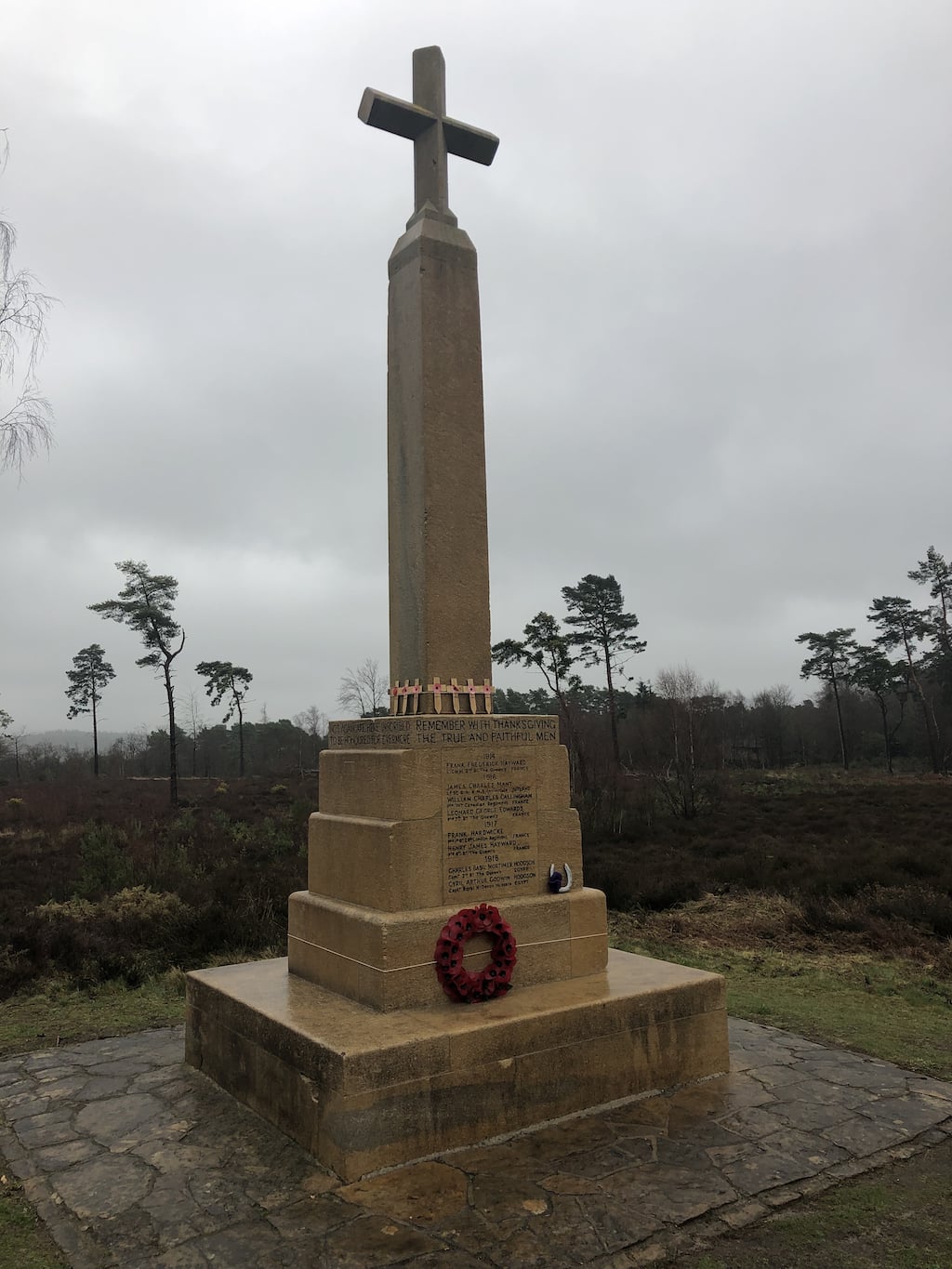
A couple of hundred metres further on, I encountered on an oddly sited, but carefully tended, monument to the Great War, and the inhabitants of Blackheath who had lost their lives in defence of our freedom.
I found the junction that I’d got wrong last time, and still had no idea which way was “right”. I plumped for “right” and was happily right. The problem is that straight-ahead takes you much more directly to St Martha’s…
At the 9.3Km mark, and I made a mental note of the distance, I spoke out loud to myself for the first time, commenting on what a ridiculous endeavour I’ve signed up for. I’d been going a good couple of hours, had 4 more ahead of me, and this was a short walk!
Tuning into the variably signed-posted route, I soon happened upon St Augustine’s Abbey, and figuring there would be good photo to be had, deviated from my route to snap the ancient architectural beauty that it would be. Somebody needs to go back to architectural school, as it seemed to be a stone built pre-war Russian monster of a building. I trust that it’s more beautiful inside, and have no doubt that it accommodates the spiritual needs of the inhabitants.
A couple of hundred metres further on, I encountered on an oddly sited, but carefully tended, monument to the Great War, and the inhabitants of Blackheath who had lost their lives in defence of our freedom.
A mirage
Yomping onwards, I passed some fantastic looking properties, quietly wondering to myself when I’d happen upon St Martha’s, which now seemed as far away as it ever had done.I was now joined by a couple of horses and their riders for a good couple of Km. I smiled to myself knowing how lucky it was that Andy was not on this walk, knowing his fear of anything larger than a Yorkshire Terrier would have left him trembling at the knees.
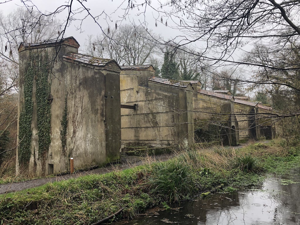
The Tillingbourne Gunpowder Mills appeared, and I was now able to mentally place myself at the foot of St Marthas. The mills look better in the spring sunshine, but it was good to see that some clearance work had been done. It’s an impressive set of buildings with a useful information leaflet that explains their history, and how a small stream (The Tillingbourne) provided dangerous employment for a large number of people.
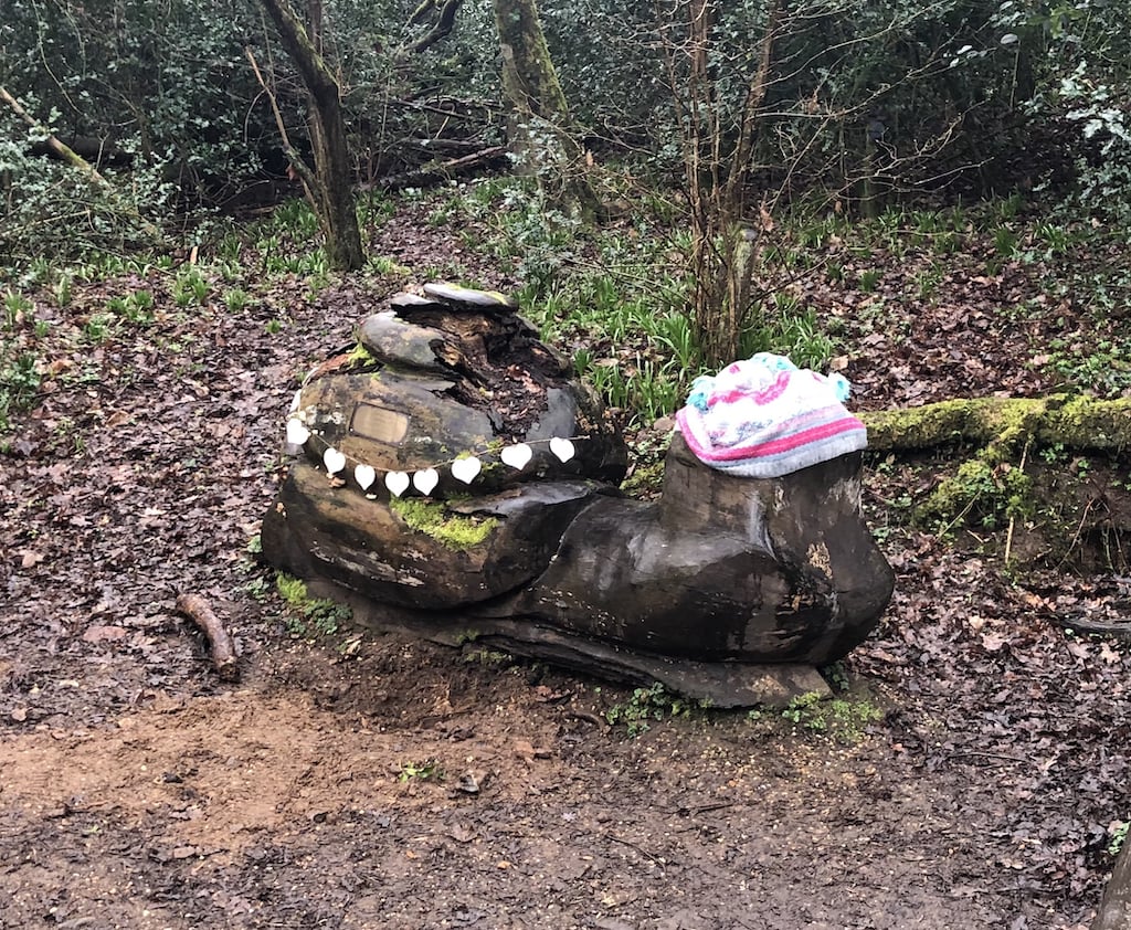
I also happened on Brian the Snail. Brian is a memorial to a young lad who enjoyed this spot, and was an expert at finding snails.
A hop, skip and a jump later, and I’d re-found the North Downs Way, opposite the pill-box on the hill. I popped my rucksack down, and happily rolled another well deserved slice of pizza.
I now had a decision. On the way up the St Martha’s climb, I’d done the mental maths on the route ahead of me. I was 15Km and 3 hours in, and knew that routing via Newlands Corner would provide coffee, cake and a 30Km trip. I also knew that it would be a further 15Km and 3 hours, and that I was slightly cold, slightly wet, and sightly bored.
As I munched puttanesca pizza, I knew that there was only one answer, which was to suck it up, and head on for another 2 football matches of walking. Two. More. Football. Matches.
I headed downhill towards Guildford Lane, and on to Newlands Corner. I was now on very familiar territory, having walked and run this area for many years. I bumped into a friend, and we were both happy to stop!
I started chunking the walk up: “2 minutes across this field”, “4 minutes to the quarry”, “3 minutes to the pill-box” etc. I like breaking things down.
As my tiredness grew, my appetite declined, and I simply had no desire to eat. Food now became a necessary chore, and I need to give this a lot of thought. I’d initially set myself to eat something at least every 5Km, but given that’s about every hour or so, that’s no good. I need to develop a system of reminding and forcing myself to eat. Part of this is having the right foods in terms of size, taste, nutrition, and as importantly, interest. I think the secret is likely to be food that is very flavoursome – whether that is savoury or sweet.
Based on my knowledge of my route and locale, I knew that heading straight home from The Chantries would bring me up short distance-wise, so with limited enthusiasm, I headed back towards Loseley along the North Downs Way, and then swung right-handed directly up the slippery side of The Mount until reaching the top. Whether it was the height, aspect, or pure chance I don’t know, but it was now hideous, with horizontal rain drenching me.
Arriving home, I put the kettle on for a much needed cup of tea, and an equally deserved pot noodle. Pot Noodles are under-estimated as recovery food!
31.8Km done. Just the other 68.2Km to go…
I now had a decision. On the way up the St Martha’s climb, I’d done the mental maths on the route ahead of me. I was 15Km and 3 hours in, and knew that routing via Newlands Corner would provide coffee, cake and a 30Km trip. I also knew that it would be a further 15Km and 3 hours, and that I was slightly cold, slightly wet, and sightly bored.
As I munched puttanesca pizza, I knew that there was only one answer, which was to suck it up, and head on for another 2 football matches of walking. Two. More. Football. Matches.
I headed downhill towards Guildford Lane, and on to Newlands Corner. I was now on very familiar territory, having walked and run this area for many years. I bumped into a friend, and we were both happy to stop!
I started chunking the walk up: “2 minutes across this field”, “4 minutes to the quarry”, “3 minutes to the pill-box” etc. I like breaking things down.
The last 10Km
A large latte and slice of Oreo chocolate cake at Newlands Corner sat badly in my stomach as I sloshed my way along Newlands Corner, back to St Martha’s, and over to The Chantries. “I’ll add this to my learnings” I mused.As my tiredness grew, my appetite declined, and I simply had no desire to eat. Food now became a necessary chore, and I need to give this a lot of thought. I’d initially set myself to eat something at least every 5Km, but given that’s about every hour or so, that’s no good. I need to develop a system of reminding and forcing myself to eat. Part of this is having the right foods in terms of size, taste, nutrition, and as importantly, interest. I think the secret is likely to be food that is very flavoursome – whether that is savoury or sweet.
Based on my knowledge of my route and locale, I knew that heading straight home from The Chantries would bring me up short distance-wise, so with limited enthusiasm, I headed back towards Loseley along the North Downs Way, and then swung right-handed directly up the slippery side of The Mount until reaching the top. Whether it was the height, aspect, or pure chance I don’t know, but it was now hideous, with horizontal rain drenching me.
Arriving home, I put the kettle on for a much needed cup of tea, and an equally deserved pot noodle. Pot Noodles are under-estimated as recovery food!
31.8Km done. Just the other 68.2Km to go…
Scores on the doors
Overall, I was very happy with the walk, not least in this was actually leaving the house! Good- Route planning
- Mental resolve
- Navigation
- Home recovery
Needs work
- Footwear
- Water-proofness of clothing
- Eating discipline
- Variety of food